It is incredible that India is not a permanent member of the United
Nations Security Council with full power of Veto . Such a thing was permitted
to happen since in 1947 India was handed over to Mr. Jawaharlal Nehru who was a
British loyalist and was not at all keen about a dominant role for India in
International affairs and rather continued Britain’s decadent and pernicious
policies even after the purported independence of India in 1947 vis-à-vis in
particular Tibet and did not have the interest of India at heart. In 1955
India’s first Prime Minister Jawaharlal Nehru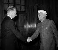
declined an offer by Russian Premier Nikolai Bulganin to accept a permanent seat in the Security Council. Nehru had suggested that the seat, till then held by Taiwan, be offered to China instead. S. Gopal writes in ‘Jawaharlal Nehru – Vol II’: “He rejected the Soviet offer to propose India as the sixth permanent member of the Security Council and insisted that priority be given to China’s admission to the UN.” In a paper titled ‘Not at the Cost of China’, Anton Harder of the Wilson Center writes that Nehru lied in Parliament about the offer of a permanent seat. “Despite Nehru’s denial then, and online debates now, the 1955 offer from the Soviets is in fact well-documented, although perhaps not widely known"." Mr. Jawaharlal Nehru lied in the Parliament of India and undermined India and acted to the detriment of India and the same was not an innocent "mistake" but a wilful one in diabolical collusion with the English and the Chinese and the same is borne out by records! India should make it clear that the entire proceedings of the Security Council are vitiated as ab initio illegal and null and void right from 1947 as India was not a member of the Security Council. India cannot permit the present permanent members to take their own sweet time to confer permanent membership in accordance with their whims and fancies and should demand membership as a matter of right and make it well known that India intends to express her own opinion on various international issues particularly the issues like inter alia the brief reunification of Iraq, independence for Tibet and the right of the Palestinians in exile to return to their country pursuant to Nakba and take back possession and ownership of their lands in their ancestral villages and towns. In fact, the 1971, United Nations General Assembly Resolution 2758 of 1971 whereby the Government of People's Republic of China was purportedly recognized as a member of the Security Council is contradicted by the Article 23 on UN Charter. India should rather call upon and issue an ultimatum and a deadline to these members and demand that India be conferred with permanent membership of the Security Council with full privileges to veto and usurp membership rather than being given in due course at a prolonged and unstimulated time. If the demand is not conceded, India should quit from this bogus, spurious and fake United Nations which is just a replica of the decadent and spurious League of Nations with cosmetic changes to give a façade to the actual nature of this bogus organization and create a parallel genuine and credible United Nations Organisation with its head Quarters at Nav Dehli and India will actuate the international community to quit the fraudulent and bogus United Nations en masse and become members of the genuine United Nations at Nav Dehli and India shall be one of the permanent 4 members of the Security Council will full power of Veto. So there! We lost that martial spirit after Netaji Subhas Chandra Bose or Ashfaqullah Khan and when the scheming and conniving regime of Mr. Jawaharlal Nehru who ran with the hare and hunted with the hounds, took over after obviously being in collusion with the British and the Chinese to the detriment of India even after alleged so-called independence in 1947 and successfully destroyed the Survey of India and converted India into a nation full of effeminate and emasculated Indians who are unable to even read a map and understand that the alleged so-called borders depicted therein are anti-Indian!

declined an offer by Russian Premier Nikolai Bulganin to accept a permanent seat in the Security Council. Nehru had suggested that the seat, till then held by Taiwan, be offered to China instead. S. Gopal writes in ‘Jawaharlal Nehru – Vol II’: “He rejected the Soviet offer to propose India as the sixth permanent member of the Security Council and insisted that priority be given to China’s admission to the UN.” In a paper titled ‘Not at the Cost of China’, Anton Harder of the Wilson Center writes that Nehru lied in Parliament about the offer of a permanent seat. “Despite Nehru’s denial then, and online debates now, the 1955 offer from the Soviets is in fact well-documented, although perhaps not widely known"." Mr. Jawaharlal Nehru lied in the Parliament of India and undermined India and acted to the detriment of India and the same was not an innocent "mistake" but a wilful one in diabolical collusion with the English and the Chinese and the same is borne out by records! India should make it clear that the entire proceedings of the Security Council are vitiated as ab initio illegal and null and void right from 1947 as India was not a member of the Security Council. India cannot permit the present permanent members to take their own sweet time to confer permanent membership in accordance with their whims and fancies and should demand membership as a matter of right and make it well known that India intends to express her own opinion on various international issues particularly the issues like inter alia the brief reunification of Iraq, independence for Tibet and the right of the Palestinians in exile to return to their country pursuant to Nakba and take back possession and ownership of their lands in their ancestral villages and towns. In fact, the 1971, United Nations General Assembly Resolution 2758 of 1971 whereby the Government of People's Republic of China was purportedly recognized as a member of the Security Council is contradicted by the Article 23 on UN Charter. India should rather call upon and issue an ultimatum and a deadline to these members and demand that India be conferred with permanent membership of the Security Council with full privileges to veto and usurp membership rather than being given in due course at a prolonged and unstimulated time. If the demand is not conceded, India should quit from this bogus, spurious and fake United Nations which is just a replica of the decadent and spurious League of Nations with cosmetic changes to give a façade to the actual nature of this bogus organization and create a parallel genuine and credible United Nations Organisation with its head Quarters at Nav Dehli and India will actuate the international community to quit the fraudulent and bogus United Nations en masse and become members of the genuine United Nations at Nav Dehli and India shall be one of the permanent 4 members of the Security Council will full power of Veto. So there! We lost that martial spirit after Netaji Subhas Chandra Bose or Ashfaqullah Khan and when the scheming and conniving regime of Mr. Jawaharlal Nehru who ran with the hare and hunted with the hounds, took over after obviously being in collusion with the British and the Chinese to the detriment of India even after alleged so-called independence in 1947 and successfully destroyed the Survey of India and converted India into a nation full of effeminate and emasculated Indians who are unable to even read a map and understand that the alleged so-called borders depicted therein are anti-Indian!


