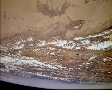
The crux of the issue regarding the McMahon line is that it was not demarcated on the crests of the Himalayas on the watershed separating the Arunachal Himalaya from the Tibetan Plateau.
Before the Chinese endeavour to annex the Assam
Himalaya which is not even geographically a part of the Tibetan Plateau, the Chinese occupiers of Tibet should integrate North West Tibet comprising the area in northwestern Tibet between the Altyn Tagh Range and the Kuen Lun Range as well as North East Tibet comprising the Amdo area in northeastern Tibet as well as the area in East Tibet comprising the Kham region in eastern Tibet extending till Mount Minyak Gangkar (Minya Konka) in eastern Tibet on the international border of Tibet and China!
Himalaya which is not even geographically a part of the Tibetan Plateau, the Chinese occupiers of Tibet should integrate North West Tibet comprising the area in northwestern Tibet between the Altyn Tagh Range and the Kuen Lun Range as well as North East Tibet comprising the Amdo area in northeastern Tibet as well as the area in East Tibet comprising the Kham region in eastern Tibet extending till Mount Minyak Gangkar (Minya Konka) in eastern Tibet on the international border of Tibet and China!
The crux of the issue is that the so-called McMahon
Line was demarcated deliberately along the foothills of the Assam Himalaya rather than on the watershed of the Assam Himalaya just because of the deceit of the Colonial English and their collusion with the Chinese. The whole McMahon Line except to the north east of Pachakshiri is ab initio illegal and the international border of India with the Sovereign States of Tibet and Burma is much further to the north on the border Passes and Peak comprising inter alia Sharkha Leb La, Yarto Tra la, Druk La, Namcha Barwa Peak , Su La , Atakang La, Yuko, Juk and Lagya on the Indo-Tibetan International Border and Zhasha Pass on the International border of India with Burma and the Namcha Barwa Peak is actually on the International border of the two Sovereign states of India and Tibet.
Line was demarcated deliberately along the foothills of the Assam Himalaya rather than on the watershed of the Assam Himalaya just because of the deceit of the Colonial English and their collusion with the Chinese. The whole McMahon Line except to the north east of Pachakshiri is ab initio illegal and the international border of India with the Sovereign States of Tibet and Burma is much further to the north on the border Passes and Peak comprising inter alia Sharkha Leb La, Yarto Tra la, Druk La, Namcha Barwa Peak , Su La , Atakang La, Yuko, Juk and Lagya on the Indo-Tibetan International Border and Zhasha Pass on the International border of India with Burma and the Namcha Barwa Peak is actually on the International border of the two Sovereign states of India and Tibet.
China does not come in the picture at all. China is situate in distant far-away East Asia and does not share
a common border neither with India nor the Sub-continent of India and inevitably, there is going to be a Sea Change in the Foreign Policy of India vis-à-vis China and inevitably, the Government of India will tell the Chinese in no uncertain terms that China does not share a border neither with the Sub-continent of India nor with India and there is nothing there to talk to the Chinese regarding the international border and India will at the appropriate time and place talk to the de jure governments of the Sovereign nations of Tibet and East Turkistan! So there!
a common border neither with India nor the Sub-continent of India and inevitably, there is going to be a Sea Change in the Foreign Policy of India vis-à-vis China and inevitably, the Government of India will tell the Chinese in no uncertain terms that China does not share a border neither with the Sub-continent of India nor with India and there is nothing there to talk to the Chinese regarding the international border and India will at the appropriate time and place talk to the de jure governments of the Sovereign nations of Tibet and East Turkistan! So there!


